
Make confident site decisions on the spot, without the consultant
Combine map data with an automated proforma to quickly validate site potential, eliminating costs, delays and consultant fees on unviable properties.
What customers say
"I love Giraffe for the speed and accuracy in generating multiple options when assessing new sites. This is particularly valuable for our new business teams."
John Taylor
Head of Product and Design - Apartments, Lendlease
"We were able to easily integrate the Giraffe technology into our current deal flow systems, which saved valuable time for all of our teams."
Dusti Wofford
Global Head of Digital & Technology Strategy, Trammell Crow Company
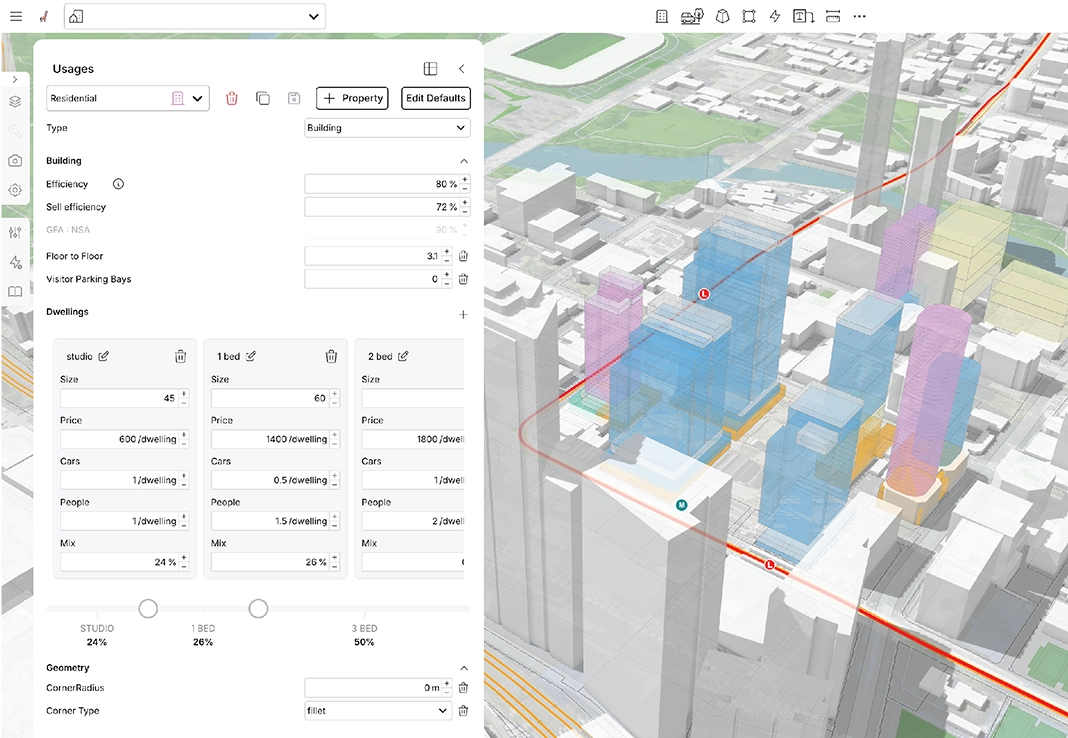
Understand the impact of your design with real-time analytics while drawing. Standardise your business assumptions into templates—apartment sizes, construction rates, floor-to-floor heights, and building designs. Use them to create workflow efficiencies that let you focus on design iterations and optimisations. Test 20 site scenarios in the time it takes others to analyse one.
Model scenarios to find the highest-return layout
Understand the impact of your design with real-time analytics while drawing. Standardise your business assumptions into templates—apartment sizes, construction rates, floor-to-floor heights, and building designs. Use them to create workflow efficiencies that let you focus on design iterations and optimisations. Test 20 site scenarios in the time it takes others to analyse one.
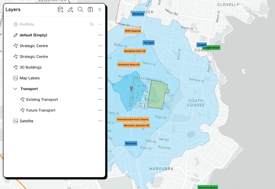
Consolidate market research onto one map
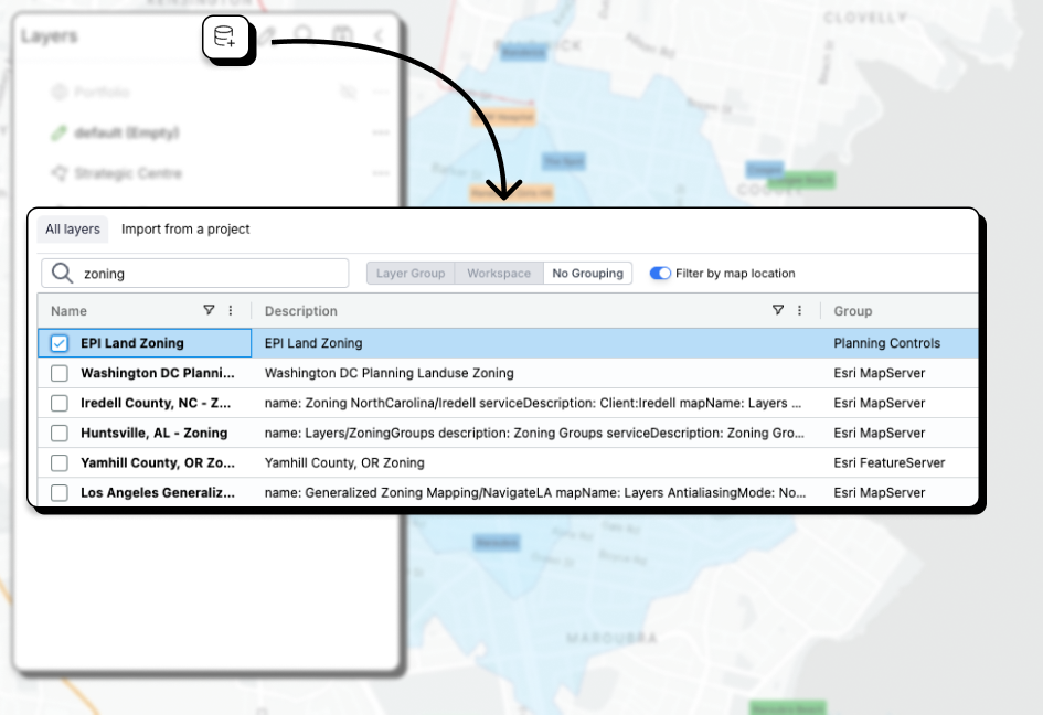
Understanding your market and context is critical to making good investment and design decisions. Giraffe lets you connect to any data source and weave them into a single pane of glass that drives transparency across your business. Data sources can be queried, filtered and visualised on the fly to drive analytics and avoid confusion.
Aggregate data layers and filter on your requirements
Finding development opportunities can be a major challenge. Data is localised and can be hard to contextualise. Giraffe lets you connect to spatial data from any location. Filter, query and layer data sets over each other. Using the Lens tool you can build a customised site search that suits your needs in any location.
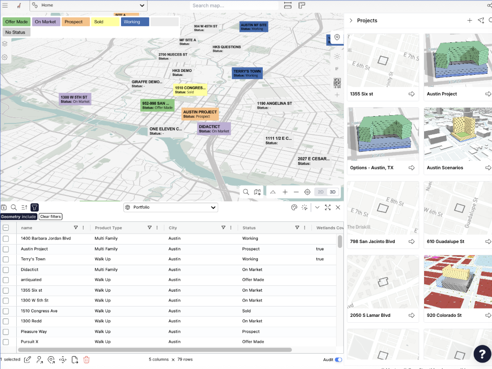
Numbers you can bank on
Facts beat hunches. Live proforma updates tell you exactly what a site is worth before you invest a cent. Access actionable site intelligence you can trust—no more chasing scattered data sources.
Giraffe is a tool, and a platform.
Giraffe is designed as a layered platform. Some teams start simple, others run their complex business processes on it. You can adopt Giraffe at the level that fits your business today, and grow into more over time.
Platform
Your core real estate operating system
A secure, globally-scaled platform for working with spatial data, workflows, and AI.
Built for developers, planners, designers, and analysts who want to move fast:
- Connect data layers and geometry
- Build and run apps and workflows
- Automate analysis and decisions
Start immediately. Extend endlessly.
Configured Data & Apps
Ready-to-use intelligence for real estate workflows
For teams that want value on day one.
We provide:
- Curated planning and market datasets
- Pre-built apps for feasibility, due diligence, site analysis, and more
- Ongoing training so your team becomes AI-enabled fast
You get the platform — plus proven workflows already configured.
Enterprise Decision System
Giraffe as a decision system across your organisation
For large developers, asset owners, governments, and consultancies.
We partner with you to:
- Integrate Giraffe into your digital & AI strategy
- Connect internal systems and proprietary data
- Build governed, repeatable decision workflows
- Automate high-value processes across teams
From pilots to organisation-wide transformation.